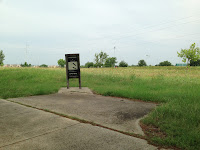
 2013.06.15 - The next on the list of 60 hikes within 60 miles around DFW is the Duck Creek Greenbelt. It seems familiar from my fanatic geocaching days, but today it will be through an walker's lens. We parked near the Surf and Swim at Audubon Park in Garland and off we went.
An urban trail, we learned from the small loop at the southern end that the small paved stations may have had exercise equipment at some time by the sole standing signs. A shame that they are gone, but us walkers, all we need is a trail. One good modern conversion of the park we noticed was the frisbee golfers.

 The early morning thunderstorm made parts of the trail muddy. However, we knew the Texas summer heat would soon burn it off. Just wish it would do the same for the Mosquitos.
With the trail being narrow it brought nature a bit closer during the Gatewood Park section of the trail as the birds chirped away. Still pretty active with joggers, walkers, and bikers, it could get crowded but our traffic jams were minimal. Actually, it is just good to see people exercising, at whatever speed.
At Bass Park, there is a pond for ducks and restful reflection. This section is quiet. The soft sound of traffic in the distance behind the wind creates an inner city get-away.
 From the various views of Duck Creek, it is pretty obvious a trash detail can be used here. That is too bad as nature doesn't need the makeup. I wonder where all that garbage comes from?
 Further north there is parking and a huge open field utilized by Cricketers. A cross over to the east side can be taken. Careful if it is muddy, the slopes up and down to Duck Creek can be tricky. There is a split of a trail here, going north toward the Northern terminus is more of a sidewalk along Duck Creek Road. It was there that I found a "Quickie" Geocache.
 From the split going south is a quicker trail, closer to the road and creek. At every quarter mile, there are yellow poles indicating the distance. It is also on this stretch that we met up with a coworker of mine. He is a smart guy that I respect we talked for a few and it made the rest of our walk more pleasurable.
 At our 4.5 mile mark, we encounter an A-Frame, Camp Gatewood Pavilion. On the end closest to the road, it has a wooden back with a couple of chimneys. This must of been or still is a place for Boy Scouts to congregate.
We were not sure where the trailed ended at Cody Park, so we walked to the Greenbelt Parkway light. At that point, we looked at our maps and decided it would be best to turnaround. Regardless, of the turnaround point, it is paved this way with a port-a-potty along the way.
 Crossing the bridge at Oates and then getting back on the trail, we recognized the same frisbee golfers we saw earlier in the day. Seems we were finishing off about the same time.
We hiked 7.11 miles in 2 hours : 51 minutes averaging 24 minutes : 04 seconds per mile. Our fastest mile was the 6th mile at 22 minutes : 32 seconds. I took about 18,000 steps.
Total blogged miles : 69.19 miles.

No comments:
Post a Comment