 2013.09.02 - Labor Day
Directions:
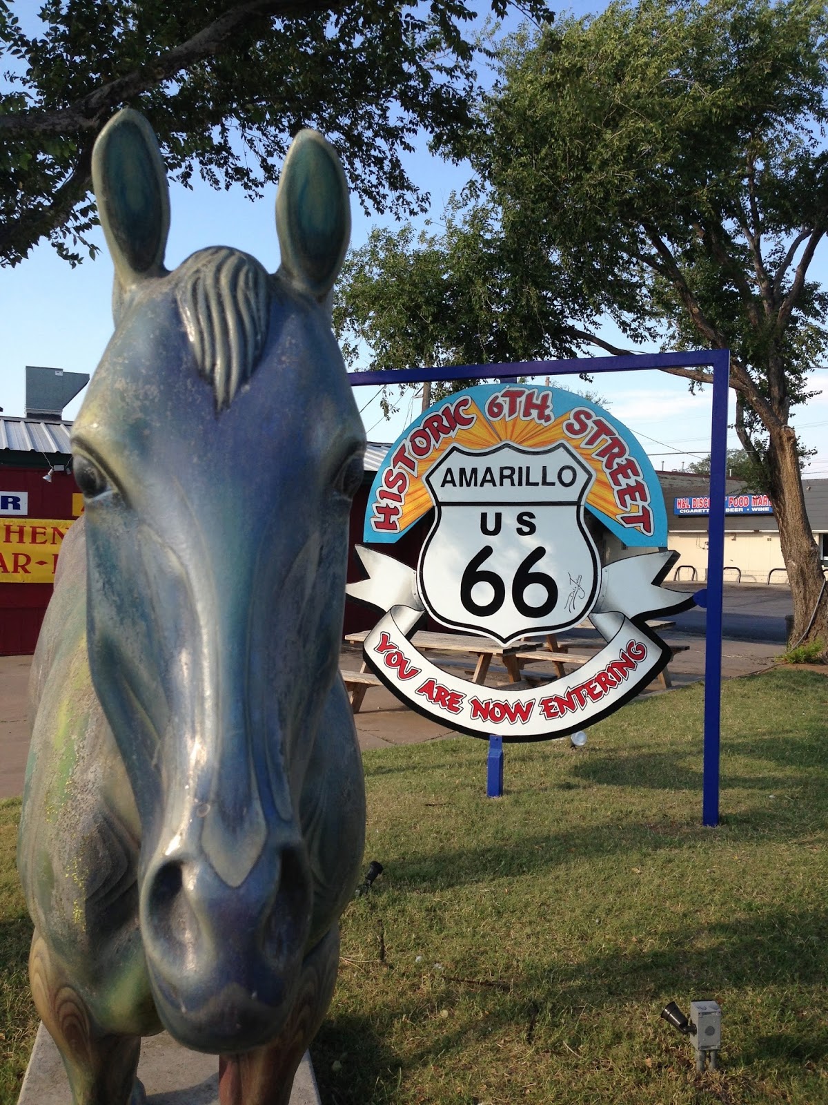
From the east it starts near Lake Michigan in Chicago and from the west near Santa Monica Peer on the Pacific Coast. However, if not traveling the whole Route 66, then exit 68B on I-40 and head north on Georgia St. to the 6th Avenue intersection where Amarillo's Route 66 district begins.
Every Trail:
We parked on Tennessee St, about half way through the district, started Runkeeper and a new app, Every Trail. I first visited Every Trail when scouting for nearby hikes, but it wasn't until this trip to Albuquerque and back that I discovered its true purpose. For one, Every Trail runs a slide show of every photo taken at its GPS location along the route. Which is fun to watch especially on this magical Mother Road. Another reason, is it gives a running elevation graph with info on duration, length, average speed, vertical up, and vertical down. A link to this trip is on the webpage under the name Route 66 - Texas.
 Walk:
Walk: Venturing west, we walked on the north side of Route 66 while enjoying the fanciful buildings to the South. Yet at the corner of Route 66 and S. Fairmont St. is a converted car hop restaurant from the what could have been American food to Filipino food. A good sign of the changing times. So many buildings along Route 66 are abandoned while this one lives on.
Another stable on Route 66 are biker bars and here in Amarillo, there are a couple. Skooteerz is at the corner of Western St. and Route 66 on the edge of the district. Here we turned around and head east. Another biker bar is the Broken Spoke Lounge and can be found between Louisiana and Virginia Streets.

 If body art is desired there is a tattoo shop on Prospect Street. But there is also street art along the Route. Across from Cornerstone Church of Amarillo is a storage container with purposeful graffiti. The haunted house at Virginia St. has historic marker in the tombstone. Between Kentucky and Florida Streets PacMan is chasing ghosts. Then on the north side between Kentucky and Alabama is my favorite. A mural of a container store truck with Route 66 on the backside. I just love murals. The last bit of art is for Ladies Bling, a biker shop mural.

Lastly, Route 66's character is reflected in its buildings. From the Solitary building at Belleview St. to Mama's Garden between Maryland and Tennessee to Cowboy Gelato between Florida and Kentucky. What could quickly be passed and missed in a car is in full display on foot. If I get the opportunity to drive Route 66 from Chicago to Los Angeles again, I hope to do the same as I did that day. Get out, get up close, and feel the ever changing heart of what once was and is America's Highway.

Numbers:
The time spent walking was 56 minutes and 17 seconds for a distance of 2.17 miles. Our vertical up was 620 feet and average speed was 2.3 miles per hour while sightseeing.
Total blogged miles: 231.10 miles.


